The crack of a twig underfoot, the crisp morning air, and the first light breaking through the trees—there’s nothing like the thrill of a hunt. But let’s be real: even the most experienced woodsman can get turned around in unfamiliar territory. That’s where today’s hunting-grade GPS (Global Positioning System) devices come in. They’re more than just digital maps; they’re your high-tech hunting partner.
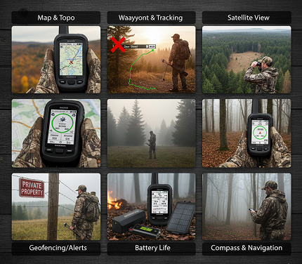
Forget the old-school compass and tattered map for a minute. If you’re serious about your success and safety this season, here are the seven must-have GPS features that will change the game.
1. OnX Integration: The Public/Landowner Intel Game-Changer
This is, without a doubt, the feature that has revolutionized modern hunting. While apps like OnX Hunt are standalone powerhouses, many GPS units now seamlessly sync with this data or offer similar layered mapping. Why is it number one? It answers the hunter’s most critical question: “Can I legally be here?”
What it does
OnX Hunt provides detailed maps with up-to-date property boundaries across more than 152 million properties nationwide, public land contours, and landowner contact information right on your screen. No more guessing if that prime buck is on public land or your neighbor’s back forty. The land ownership maps are generally accurate to within 5 to 10 feet, thanks to data sourced from verified county, state, and federal records.
The platform has become so trusted that more than 2,000 game wardens around the country approve of onX Hunt as an accurate tool in the field. This proprietary data collection and analysis is handled by a dedicated Geographic Information System team that ensures maps are continuously updated across all devices.
Advanced Features That Set It Apart
OnX Hunt now offers trail camera integration, where images from compatible trail cams sync directly to your map, allowing you to view and organize photos by location. Elite members unlock advanced tools like deer-only photo alerts and movement insights based on wind, time of day, and time of year, turning trail camera photos into actionable intelligence.
Recent innovations include Lidar Topo Maps that reveal subtle terrain features other maps miss, helping hunters find new spots with high-definition elevation detail. The platform also features a Deer Movement Forecast tool available to Elite members, which predicts whitetail patterns and monitors the chance of increased deer activity day by day.
The TerrainX feature gives hunters the ability to analyze specific slope angles and aspects such as north-facing or south-facing terrain, along with specific elevation bands crucial for early and late season hunts. The Viewshed Tool visualizes what can be seen from any point on the map, making it easier than ever to identify prime glassing knobs.
The Hunting Edge
It allows you to confidently plan access routes, identify pockets of public land that others might miss, and ensure you’re always hunting ethically and legally. OnX covers more than 985 million acres of public land and nearly 10,000 unique hunting units, with 421 map overlays available. The platform enables you to hunt across state lines seamlessly—Premium membership covers single states starting at around $35 annually, while Elite Nationwide membership provides access to all 50 states and Canada.
OnX Hunt now supports in-dash navigation through Apple CarPlay and Android Auto, allowing hunters to access hunting maps, GPS tools, and offline maps directly from their vehicle’s touchscreen display. This hands-free access is ideal for route planning and boundary scouting when driving to or through hunting areas.
2. Public/Private Land Mapping (The Foundation)
Even without a specific app integration, high-quality land classification is non-negotiable. Your GPS should come pre-loaded with detailed maps that clearly differentiate between:
- BLM (Bureau of Land Management) Land
- National Forests
- State Wildlife Management Areas
- Private Property
Modern GPS hunting cards like the Garmin HuntView Plus feature 1:24,000 scale topographic mapping and identify landowner names and boundaries for public and private land types, using data from multiple sources including BLM, National wildlife refuges, National parks, WPA (Waterfowl Production Areas), and WMA (Wildlife Management Areas).
Seeing this color-coded information at a glance allows for on-the-fly decision-making when you’re tracking game or scouting new territory. These preloaded microSD cards offer full state-by-state coverage with routable road and trail data, food and fuel locations, and hunting management unit boundaries containing multiple species information where applicable.
The sophistication of modern land mapping extends beyond simple boundary lines. Today’s best systems incorporate food plot identification, timber land designations, section information for public land access, and even recent satellite imagery that’s updated as frequently as every two weeks, providing critical information about current recreation conditions.
3. Waypoint & Track Logging: Your Digital Breadcrumb Trail
This is the core function that made GPS a hunter’s best friend. But it’s not just about marking your truck.
Waypoints: Your Memory in the Field
Use them to mark everything—that giant rub line, a hidden water source, the spot where you last saw that herd of elk, or your tree stand. OnX Hunt allows hunters to mark each tree stand, trail camera, and deer sign with custom waypoints using specific icons and names. This helps you visualize new stand sites, analyze how deer use your land, and ultimately make you more successful by gaining a deeper understanding of the property you hunt.
Pro tip: Use specific icons and names (e.g., “Big_Buck_Rub_10-22”) so you know exactly what you’re looking at later. Modern systems allow you to attach photos directly to waypoints, create detailed notes about conditions when you marked the location, and even record the date and time automatically for future reference.
Advanced features include the Area Shape Tool to size up food plots and measure specific hunting zones, and the Line Distance Tool to calculate the exact distance to the nearest access point or between key locations. This precision planning translates to quieter approaches and more strategic positioning.
Track Logging: Your Safety Net
This feature automatically creates a literal “breadcrumb trail” of your entire route. The Bushnell BackTrack Mini serves as a breadcrumb tracker with a compass feature, weighing just 2 ounces while providing up to 35 hours of battery life. If you get disoriented in thick fog or a whiteout, just select your track and hit “Track Back” to be guided safely to your starting point. It’s your ultimate safety net.
Track logging serves multiple purposes beyond navigation. You can analyze your hunting patterns over time, identify which routes produce the most game encounters, share successful approaches with hunting partners, and even use the data to calculate total distance covered and elevation gained during your hunt. This information becomes invaluable for physical conditioning and future hunt planning.
4. Satellite & Topo Map Overlays: Seeing the Whole Picture
The best hunters read the land. Your GPS should help you do that by allowing you to layer different map types.
Topographic Maps: Reading the Terrain
Modern hunting GPS systems feature 1:24,000 scale topographic mapping that shows the lay of the land through contour lines, elevation changes, ridges, draws, and saddles. This is essential for understanding game movement, planning a quiet approach, and setting up an effective ambush.
Today’s advanced topo maps go beyond traditional contour lines. They integrate trail grade information, showing steep sections color-coded by difficulty. This feature proves invaluable when planning approach routes in mountainous terrain, helping hunters avoid exhausting climbs or dangerous descents in low-light conditions.
OnX Hunt provides three types of basemaps: Satellite shows aerial imagery of terrain, Topographic gives a two-dimensional representation of Earth’s three-dimensional landscape, and Hybrid combines all the advantages of topographic maps and aerial imagery. Understanding the lay of the land becomes easier with 3D maps available on both desktop and mobile, allowing you to visualize terrain from multiple angles before ever setting foot in the field.
High-Resolution Satellite Imagery: The Real-World View
Seeing an actual satellite photo lets you identify real-world features that topo lines can’t show: specific oak groves, edge habitats, clear-cuts, and even faint game trails. GPS systems like Garmin’s BirdsEye Satellite Imagery allow you to download high-resolution, photo-realistic maps to your device without an annual subscription.
The latest innovations in satellite imagery include “leaf-off” winter imagery, which is particularly valuable for waterfowl hunters and anyone trying to identify creek beds, marshes, and water features that flow under tree canopies. The ability to toggle between recent summer imagery and winter views provides comprehensive year-round scouting capabilities.
Toggling between the satellite and topo views gives you the ultimate strategic perspective, allowing you to identify terrain funnels, pinch points where game naturally travels, and optimal stand locations that combine elevation advantage with natural cover.
5. “TracBack” or “Backtrack” Feature: Your Get-Home-Free Card
We mentioned it briefly, but this feature deserves its own spot. When you’re miles deep in the backcountry and visibility drops or the landscape looks completely different on your return trip, panic can set in.
The TracBack feature uses your recorded track log to guide you, turn-by-turn, back to your starting point along the exact path you came. It’s the modern, foolproof version of leaving a trail of breadcrumbs. Even budget GPS devices like the Bushnell BackTrack Mini provide this essential breadcrumb navigation feature, helping you find your way back safely.
This feature becomes particularly critical in dangerous situations. Whether you’re dealing with an unexpected snowstorm that obscures landmarks, helping another hunter who’s made a marginal shot on game and needs to track it through unfamiliar territory, or simply turned around in thick timber after an adrenaline-filled pursuit, the TracBack function provides peace of mind and potentially life-saving guidance.
The Garmin Foretrex 801 wearable GPS device offers TracBack navigation along with four operational modes that can increase battery life from 100 to 1,000 hours, making it ideal for extended backcountry hunts where getting back to camp safely is paramount.
6. Wireless Syncing & Sharing: Teamwork Makes the Dream Work
Gone are the days of manually entering your buddy’s coordinates. Modern GPS units often feature Bluetooth or Wi-Fi connectivity.
What it does
GPS systems with BaseCamp software let you interface your computer with your handheld device to plan your hunt, transfer waypoints, and keep a track log so you can return to the best hunting spots or share adventures online. You can wirelessly sync your waypoints, tracks, and maps between your GPS and your phone or computer.
OnX Hunt’s Offline Sharing feature allows you to keep all members of your hunt party in the know, whether you’re updating each other from various stands throughout the day, making sure everyone knows where camp is, or letting each other know where you’re moving. Importantly, this works even when you’re beyond cell service, maintaining safety and coordination in remote locations.
The Hunting Edge
If your buddy spots a monster bull across the canyon, he can instantly send you the waypoint. You can also pre-scout on your computer at home and seamlessly send all your marked spots directly to your device in the field. OnX allows you to organize map content into folders and invite others to view or contribute collaboratively, making it easy to plan hunts, share stand locations, or scout access points with a team.
The collaborative features extend to smartwatch integration. OnX Hunt enables you to instantly drop waypoints from your wrist using compatible smartwatches without having to pull your phone from your pocket, keeping you focused on the hunt while still documenting crucial locations.
Advanced hunters use wireless syncing to build comprehensive hunting databases. By syncing data from multiple seasons, you can identify patterns in game movement, track successful strategies across different weather conditions, and build a knowledge base that improves with each passing year. This institutional knowledge becomes particularly valuable when introducing new hunters to your group or returning to a property after several seasons away.
7. Rugged, Weatherproof & Long-Lasting Battery
All the high-tech features in the world are useless if your device dies in two hours or shatters after one drop. A hunting GPS isn’t a smartphone; it’s a tool built for abuse.
Ruggedness: Built for the Backcountry
Most Garmin handheld GPS units are IPX7-rated, meaning they’re waterproof up to 1 meter for 30 minutes—capable of handling rain, snow, and even river crossings. The IPX7 waterproof rating means devices can be submerged for up to 30 minutes at a depth of up to 1 meter, making them capable of handling any rain or snow and surviving a fall into a creek or shallow river.
Premium devices like the Garmin Montana 700 carry both an IPX7 waterproof rating and a MIL-STD-810 rating against thermal shock, water, and vibrations, ensuring they can withstand the extreme conditions encountered during mountain hunts or harsh weather pursuits.
The Garmin Foretrex 801 is a fully functional wearable GPS device that boasts MIL-STD-810 plus IPX7 ratings, with hands-free operation that makes it popular for hunters. Military-grade construction means these devices are tested against temperature extremes, from well below freezing to scorching desert heat, along with resistance to dust, impact, and vibration.
The durability extends to screen construction as well. Many premium hunting GPS units feature chemically strengthened glass that resists scratches and cracks, even when subjected to the rough treatment common during backcountry hunting. Rubberized grips and reinforced corners provide additional drop protection, recognizing that fumbles happen when your hands are cold or you’re moving quickly through rough terrain.
Battery Life: All-Day Performance and Beyond
Depending on the model and usage settings, Garmin GPS handhelds provide anywhere from 16 to 35 hours of reliable battery life on a single charge. Many models also offer battery-saving expedition modes that dramatically extend runtime when you need maximum endurance.
The Garmin GPSMAP 66i can achieve up to 200 hours of battery life in Expedition mode while using inReach technology, making it ideal for extended backcountry hunts spanning multiple days. The budget-friendly Garmin eTrex SE boasts an impressive 168 hours of battery life in standard mode, extending to an incredible 1,800 hours in expedition mode.
For ultimate flexibility, many hunters prefer devices that accept replaceable AA batteries. This eliminates charging concerns on multi-day trips—simply pack extra batteries and swap them as needed. The Garmin Foretrex 801 is powered by 2 AAA batteries (lithium, NiMH, or alkaline) and requires only recalibration when new batteries are installed, providing true peace of mind in remote locations where charging isn’t an option.
Opt for a device that promises a full day (12+ hours) of use on a single charge as a minimum standard, preferably with a power-saving mode. Many hunters also use external battery packs for multi-day trips, ensuring they can keep their GPS running even during week-long expeditions into the wilderness.
Advanced GPS Technology: Multi-Constellation Satellite Systems
Modern hunting GPS devices have evolved far beyond the original GPS-only systems. Today’s devices link multiple networks including GPS, GLONASS, Galileo, and BeiDou to pull information from numerous satellites to identify your specific location, with tracking improved by the addition of barometric altimeters and three-axis compasses.
There are four operational global navigation satellite systems: the United States’ GPS, Russia’s GLONASS, China’s BeiDou, and the European Union’s Galileo. GPS operates with 31 satellites, GLONASS has 24, Galileo operates 30, and BeiDou leads with over 35 satellites.
The practical benefit of multi-constellation support is significant for hunters. Using multiple GNSS systems increases the number of visible satellites, improves positioning accuracy, and shortens convergence time. In challenging environments like steep canyons, dense forests, or mountainous terrain where satellite visibility may be limited, having access to 80+ satellites across all systems versus just 24 from GPS alone dramatically improves reliability.
Galileo currently offers the best accuracy for civilian applications, often delivering sub-meter precision, while GPS provides around 3 to 5 meters of accuracy for civilian users. For hunters, this enhanced precision means more accurate waypoint placement, better tracking of complex routes through difficult terrain, and increased confidence in boundary identification when hunting near property lines.
Practical Buying Considerations
When selecting a hunting GPS device in 2024-2025, consider these real-world factors:
Screen Size and Readability: Screen sizes range from compact 1.3-inch displays on devices like the inReach Mini 2 to larger 3-inch screens on the GPSMAP 67 series. Larger screens are helpful for glancing at information quickly during motorized activities or when hunting on horseback, while smaller, lighter devices are preferred for backpacking and long-distance hiking.
Touchscreen vs. Buttons: Touchscreen handheld GPS devices are difficult to use when the weather is cold or wet, as you can’t operate a touchscreen without touchscreen gloves. For serious hunting applications, button-operated devices provide reliability in all conditions.
Subscription Requirements: Many GPS units allow you to upload maps without a subscription, but most require a subscription for features like up-to-date weather data and the ability to communicate with family and friends and get rescue help. Factor these ongoing costs into your purchase decision.
Emergency Communication: InReach technology keeps you in touch with family and friends while on your adventure, and allows you to trigger an interactive SOS message so help can be on the way 24/7/365 should things go from bad to worse. For solo hunters venturing into remote areas, this feature provides invaluable peace of mind.
Gear Up and Get Out There
This hunting season, don’t just rely on luck. Equip yourself with a GPS device that leverages these powerful features. You’ll hunt more intelligently, cover ground more efficiently, and most importantly, you’ll have the peace of mind that comes with knowing you can always find your way home.
The technology available to today’s hunters represents a quantum leap from even a decade ago. With accurate land ownership information, high-resolution satellite imagery, offline functionality, emergency communication capabilities, and battery life measured in days rather than hours, modern GPS devices have become as essential as a reliable rifle or a sharp knife.
Whether you choose a dedicated handheld GPS unit for its ruggedness and extended battery life, integrate app-based solutions for their comprehensive features and ease of use, or employ a combination of both for redundancy, the investment in quality navigation technology pays dividends in success, safety, and peace of mind.
Now get out there, stay safe, and happy hunting!
*) If you enjoyed this article, here are some related posts you might find interesting.
Black Friday GPS Deals 2025: Your Expert Guide
Garmin vs. Apple Watch: The Ultimate Outdoor Adventure Guide