You’ve done your research, packed your gear, and you’re ready to venture beyond the reach of cell towers. Whether you’re a hardcore backpacker, an overlanding enthusiast, or a weekend warrior, one question is critical for safety: what device do you trust to call for help when there’s no signal?
In the world of backcountry safety, two champions stand out: the Personal Locator Beacon (PLB) and the Satellite Messenger. While they might seem similar at a glance, they are fundamentally different tools designed for different types of adventurers. Choosing the right one isn’t just about features—it’s about understanding how they could save your life.
Let’s break down the showdown.
The Quick and Dirty Summary
Think of it this way:
A PLB is your 911 call. It’s a single-purpose, brute-force device with one job: scream for rescue with incredible power when things have gone horribly wrong.
A Satellite Messenger is your backcountry smartphone. It’s a versatile communicator that lets you send “I’m okay” messages, track your journey, and, yes, call for help with context.
The distinction between these two technologies has become increasingly important as outdoor recreation has surged in popularity. Search and rescue operations across the United States have reported significant increases in backcountry incidents over the past decade, making reliable emergency communication more critical than ever. Understanding which device best suits your adventure style isn’t just about convenience—it’s about ensuring you have the right tool when every second counts.
Now, let’s get into the nitty-gritty.
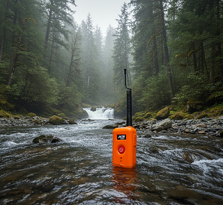
The Personal Locator Beacon (PLB): The No-Nonsense Lifeline
A PLB is all about maximum reliability in a worst-case scenario. It’s registered to you, personally, with national search-and-rescue (SAR) authorities.
How it Works:
PLBs operate on an international, government-regulated satellite system called Cospas-Sarsat. This is the same system used by ships and aircraft. When you activate it, it blasts a powerful, unbreakable distress signal on the 406 MHz frequency directly to SAR agencies worldwide. The cavalry it summons is official—think Coast Guard, Air Force, and local sheriff’s departments.
The Cospas-Sarsat system represents decades of international cooperation among space agencies and rescue organizations. Originally established in 1979 through a partnership between the United States, Canada, France, and the former Soviet Union, the system has expanded to include ground stations and satellite coverage worldwide. This network processes thousands of distress signals annually, coordinating rescues from the remotest corners of the planet to open ocean emergencies.
When you activate a PLB, the signal is picked up by satellites in both low-Earth orbit and geostationary orbit. The low-Earth orbit satellites provide global coverage and Doppler positioning, while geostationary satellites offer immediate alert capability for areas within their coverage zone. This redundant architecture ensures your distress signal reaches rescue authorities even in challenging conditions.
Key Features of a PLB:
One Button, One Job: Activate the antenna, press the button, and help is on the way. Modern PLBs like the ACR ResQLink series are designed with simplicity in mind—there’s no complex menu system, no pairing with smartphones, and no subscription portal to navigate. In a true emergency, when you might be injured, hypothermic, or in shock, this straightforward operation can be lifesaving.
No Subscription Fees: You buy it, you register it, and it’s yours for its entire battery life (typically five to seven years). PLB devices like the ACR ResQLink 400 and ResQLink View require no ongoing payments, making them an economical choice for infrequent users. The battery replacement cost after five years is typically between $150 and $250, depending on the model and whether you need professional recertification.
Incredible Signal Power: The 406 MHz signal is designed to punch through thick canopy and in challenging terrain. PLBs transmit at 5 watts—significantly more powerful than satellite messengers, which typically operate at 1.6 watts or less. This additional power means your distress signal can reach satellites even when terrain features, dense forest, or adverse weather might attenuate weaker signals.
Integrated Homing Beacon: Most modern PLBs include a 121.5 MHz homing signal that allows SAR teams to pinpoint your exact location once they are close. Some advanced models, like the ACR ResQLink AIS, also incorporate Automatic Identification System technology for maritime environments, broadcasting your position to nearby vessels equipped with AIS receivers—adding another layer of rescue coordination.
Required by Law to be Registered: This ensures SAR knows who you are, your emergency contacts, and what vehicle you might be in before they even launch. In the United States, registration is managed through NOAA (National Oceanic and Atmospheric Administration), while other countries have their own registration authorities. This registration creates a vital information bridge between you and rescue services, potentially saving crucial minutes during the initial response phase.
Built-in Self-Test Capabilities: Quality PLB units feature self-test functions that verify GPS acquisition, battery status, and signal transmission capability without actually triggering an emergency alert. The ACR ResQLink View goes a step further with a digital display showing GPS coordinates, test results, and battery status—providing confidence that your beacon will function when needed.
Extreme Durability: PLBs are built to military specifications for durability and environmental resistance. Most units are waterproof to depths of 15 feet or more, operate across temperature ranges from -4°F to 140°F, and are designed to survive impacts, drops, and the rough handling that might occur during an actual emergency. The ACR ResQLink weighs just 4.6 ounces and measures 3.9 inches tall, making it barely larger than a smartphone but significantly more rugged.
24+ Hour Operating Time: Once activated, a PLB will continuously transmit for a minimum of 24 hours, with many units capable of operating for 48 hours or longer. This extended transmission time ensures rescue services can locate you even if weather delays the initial response or if you’re in an extremely remote location requiring multi-day search efforts.
The Downside:
No Two-Way Communication: You have no way of knowing if your signal was received. You just have to trust the system and wait. In an emergency, this lack of confirmation can create psychological stress—you’ve activated your beacon, but you have no indication that anyone knows you’re in trouble. However, the Cospas-Sarsat system has proven extremely reliable, with a near-perfect detection rate for properly activated beacons with clear sky visibility.
False Alarm Anxiety: Accidentally triggering it is a big deal. You must contact authorities immediately to call off a very expensive rescue mission. False alarms from PLBs cost taxpayers thousands of dollars per response and tie up SAR resources that might be needed for genuine emergencies. Most false activations occur due to improper storage, accidental button presses, or lack of familiarity with the device. Quality PLBs include safety covers and multiple activation steps to prevent inadvertent triggering.
It’s for Life-and-Death Only: You can’t use it to tell your partner you’re running late or to check the weather. A PLB is strictly an emergency device. There’s no capability for routine communication, which means you’re completely off-grid for non-emergency situations. This limitation makes PLBs less suitable for users who want to maintain regular contact with family or coordinate logistics during extended trips.
Registration Must Be Current: An unregistered or improperly registered PLB significantly delays rescue response. SAR coordinators need to verify the emergency is legitimate and gather information about the situation. With proper registration, this process takes minutes; without it, authorities may spend hours attempting to identify the beacon owner and assess the situation.
Best For: Solo ocean sailors, pilots, and adventurers in extremely remote, high-risk environments where a catastrophic failure means you need the absolute most powerful and direct line to search and rescue. PLBs are particularly valuable for activities where the probability of needing rescue is low, but the consequences of not getting help are severe—think solo Alaskan wilderness expeditions, high-altitude mountaineering, or trans-oceanic sailing.
The Satellite Messenger: The Backcountry Communicator
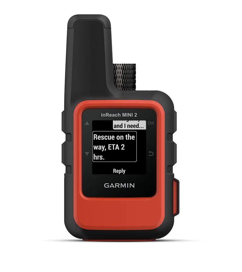
This is the category that includes popular devices like the Garmin inReach series (including the Messenger, Mini 2, and the new Messenger Plus), SPOT Gen4, ZOLEO, and the Bivystick. These devices use commercial satellite networks (primarily Iridium or Globalstar) to enable two-way communication.
How it Works:
Instead of a single distress frequency, these devices connect to commercial satellite constellations, functioning much like a very basic, text-based smartphone for the entire planet. The Garmin inReach family utilizes the Iridium satellite network, which consists of 66 active satellites in low-Earth orbit providing genuine pole-to-pole coverage. SPOT and Globalstar devices use the Globalstar constellation, which offers coverage across most populated regions but has gaps in extreme polar areas and some deep valleys.
Satellite messengers establish a bidirectional data connection with orbiting satellites, allowing them to transmit your location, text messages, and SOS alerts while receiving incoming messages, weather forecasts, and confirmation of receipt. This two-way capability fundamentally changes the emergency response dynamic—instead of simply broadcasting a distress call, you can provide context, updates, and ongoing information to rescue coordinators.
Key Features of a Satellite Messenger:
Two-Way SOS: This is the killer feature. When you trigger an SOS, a dedicated emergency response coordination center (like GEOS for Garmin inReach devices) texts you back. You can describe your emergency, the number of people involved, and your condition. This context is invaluable for SAR. Imagine the difference between simply knowing someone activated a distress beacon versus receiving a text message stating “Compound fracture right leg, unable to walk, one person, conscious and alert, no other injuries, clear weather.” The latter allows SAR teams to prepare appropriate equipment, personnel, and medical resources before they even leave the staging area.
Check-Ins and Messaging: You can send pre-set “I’m OK” messages or free-form texts to loved ones via SMS or email. The Garmin inReach Messenger provides up to 28 days of battery life in 10-minute tracking mode, making it practical for extended expeditions. Preset messages can be configured through the companion app and sent with a single button press—perfect for routine check-ins without draining your battery with extended device usage. Custom messages offer unlimited flexibility to communicate specific situations, coordinate logistics, or simply share experiences with friends and family.
Location Tracking: Many devices allow you to share a live map link so friends and family can follow your journey in near real-time. This feature serves multiple purposes beyond peace of mind—it creates a digital breadcrumb trail that can be invaluable if you do require rescue, provides accountability for solo travelers, and allows remote monitoring of your progress along planned routes. Tracking intervals are typically adjustable from continuous updates to hourly check-ins, balancing battery life against the granularity of location data.
Weather Forecasts: Most services offer the ability to request detailed weather reports for your exact location. For backcountry users, accurate weather information can prevent emergencies before they occur. Marine forecasts, extended outlooks, and location-specific predictions help you make informed decisions about whether to push forward, set up camp early, or alter your route. Recent service updates have made weather requests count as a single text message rather than consuming multiple message credits.
Photo and Voice Messaging: The newest devices like the Garmin inReach Messenger Plus, introduced in September 2024, have expanded capabilities to include photo and voice message transmission via satellite. This represents a significant advancement in satellite communication technology, allowing users to share visual documentation of situations or send voice recordings when typing is impractical. While photo transmission requires more bandwidth and battery power than text messages, the ability to show rather than describe a situation can be invaluable in certain scenarios.
Integration with Smartphones and Other Devices: Modern satellite messengers pair with smartphones via Bluetooth, leveraging your phone’s larger screen, full keyboard, and processing power while using the messenger unit solely for satellite connectivity. The Garmin inReach Messenger can pair with select Garmin handhelds, wearables, and marine equipment, creating an ecosystem of connected devices that share location data and communication capabilities.
MapShare Portal: Garmin’s MapShare feature provides a public or password-protected webpage where contacts can view your location, read your messages, and even send replies without needing a satellite phone or special equipment. This web-based interface democratizes communication, allowing anyone with internet access to stay connected with you, regardless of your remote location.
Advanced Routing and Navigation: When paired with GPS-enabled devices, satellite messengers can display routes, waypoints, and topographic information, essentially serving as a navigation platform in addition to a communication tool. Some users pair their inReach with handheld GPS units or marine chartplotters, creating redundant navigation systems with integrated emergency communication.
The Downside:
Subscription Required: This is the biggest difference. You must pay a monthly or annual fee to keep the service active. As of early 2025, Garmin inReach subscription plans range from approximately $15 per month for basic safety plans to $50 per month for unlimited messaging. Recent price adjustments have made these services more competitive—the mid-tier plan decreased from $35 to $30 per month while increasing included messages from 40 to 150. SPOT devices typically cost less for basic plans but offer fewer two-way communication features. ZOLEO requires a $40 activation fee plus monthly service fees starting around $20. These recurring costs can add up significantly over time, particularly for users who maintain year-round subscriptions despite seasonal activity.
Variable Coverage: While the Iridium network (used by Garmin) has truly global coverage, others (like SPOT’s Globalstar) can have gaps in steep valleys or at extreme latitudes. The Globalstar constellation has no coverage above approximately 70 degrees latitude, making these devices unsuitable for high-Arctic or Antarctic expeditions. Even with Iridium coverage, satellite messengers require clear sky visibility for reliable transmission—deep canyons, heavy forest canopy, or adverse weather can delay message delivery until the device acquires a clear satellite view.
Less “Brute Force” Signal: The signal isn’t as powerful as a PLB’s 406 MHz blast, though in practice, with a clear view of the sky, it’s exceptionally reliable. Satellite messengers typically transmit at 1.6 watts compared to a PLB’s 5 watts. This difference becomes significant in marginal conditions where terrain or vegetation partially obscure the sky. However, the two-way nature of satellite messengers provides confirmation of receipt—you’ll know within minutes whether your message was successfully transmitted, allowing you to reposition or retry if necessary.
Battery Management: Unlike PLBs with their multi-year standby battery life, satellite messengers require regular recharging. The Garmin inReach Messenger offers up to 28 days in tracking mode, but continuous messaging or frequent GPS updates can drain the battery in days. Users must plan for battery management, carrying portable power banks or solar chargers for extended trips. Cold weather significantly reduces battery performance, requiring users to keep devices warm or carry extra capacity.
Complexity: Satellite messengers have more features, which means more potential points of failure and a steeper learning curve. Users must familiarize themselves with the device interface, subscription portal, message composition, tracking settings, and smartphone pairing. This complexity can create operational challenges in emergency situations if users haven’t practiced with the device beforehand. The learning curve isn’t steep, but it’s notably more involved than the single-button operation of a PLB.
Best For: The vast majority of backcountry users—hikers, campers, climbers, and overlanders—who want the peace of mind of SOS combined with the everyday utility of staying connected. Satellite messengers excel in scenarios where communication enhances safety and coordination: group expeditions requiring logistics coordination, guided trips where leaders need to communicate with base operations, extended adventures where weather updates inform route decisions, and any situation where the ability to request non-emergency assistance (vehicle recovery, equipment resupply, minor medical advice) prevents minor problems from escalating into genuine emergencies.
Head-to-Head: The Final Comparison
| Feature | Satellite Messenger | Personal Locator Beacon (PLB) |
|---|---|---|
| SOS Signal | Two-way text communication with emergency coordinators | One-way broadcast to government SAR; no confirmation |
| Network | Commercial (Iridium/Globalstar) | Government (Cospas-Sarsat) |
| Signal Power | ~1.6 watts | 5 watts |
| Cost Structure | Device ($300-$500) + Monthly/Annual Subscription ($180-$600/year) | Device only ($300-$400); Battery replacement every 5-7 years ($150-$250) |
| Battery Life | Rechargeable; Days to weeks depending on usage | Non-rechargeable; 24+ hours when activated; 5-7 years standby |
| Primary Use | Communication, tracking, weather, and SOS | SOS only |
| Registration | Optional for basic features; required for emergency services | Mandatory with national authorities (NOAA in US) |
| Two-Way Communication | Yes—can receive confirmation, updates, and instructions | No—one-way distress signal only |
| Non-Emergency Use | Yes—regular messaging, tracking, check-ins, weather | No—emergency activation only |
| Coverage | Iridium: Global; Globalstar: Gaps in extreme latitudes and deep terrain | Truly global via satellite constellation |
| False Activation | Less critical—can immediately cancel via two-way messaging | Extremely serious—launches full SAR response |
| Typical Users | Hikers, Campers, Overlanders, Group Expeditions, Four-Wheelers | Sailors, Pilots, Solo Extreme Remote Adventurers, Maritime Users |
| Weight | 3-4 oz (inReach Messenger); varies by model | 4.6 oz (ACR ResQLink); similar across models |
| Additional Features | GPS navigation, weather forecasts, MapShare tracking portal, smartphone integration | Self-test capability, built-in strobe, AIS transmission (some models) |
| Response Coordination | Private emergency response center (GEOS, etc.) coordinates with local SAR | Direct to government SAR authorities |
| Message Context | Can describe situation, injury details, number of people, urgency level | Location only; no ability to provide situation details |
The Verdict: Which One is Right for Your Pack?
For 95% of adventurers, a Satellite Messenger is the clear winner. The ability to communicate during a non-life-threatening situation (a twisted ankle, a lost trail, a broken-down vehicle) is a game-changer. It prevents a manageable problem from turning into a dire emergency and provides priceless peace of mind to those waiting at home.
Consider the satellite messenger if you:
- Take regular backcountry trips throughout the year and want year-round communication capability
- Travel with groups where coordination and check-ins improve safety and logistics
- Want your family to track your progress and know you’re safe without constant cell phone contact
- Venture into areas where weather conditions can change rapidly and forecasts inform critical decisions
- Engage in activities where mechanical failures or minor injuries might require non-emergency assistance
- Value the peace of mind that comes from knowing you can ask questions, request advice, or coordinate extraction before a situation becomes critical
- Are willing to pay ongoing subscription costs for expanded communication capabilities
Reserve the PLB for the most extreme scenarios—think sailing across the Pacific, trekking in Antarctica, bush flying in Alaska, or any situation where you are so remote that your only conceivable need for the device is a true, last-ditch “save my life” signal where maximum, government-grade signal power is the top priority.
Consider the PLB if you:
- Engage in activities with extremely low communication needs but catastrophic consequences if rescue is required
- Want a zero-subscription-cost emergency device that requires no maintenance between battery replacements
- Prefer the simplicity of a single-purpose device with no smartphone pairing, app configuration, or subscription management
- Venture into environments where the 5-watt signal power provides crucial additional reliability (dense forest, mountainous terrain, high seas)
- Already have other communication methods for non-emergency situations and need only a last-resort backup
- Are legally required to carry emergency beacons (certain maritime or aviation activities)
The Hybrid Approach: Some serious adventurers carry both. A satellite messenger handles routine communication, weather updates, and coordination, while a PLB serves as a bulletproof backup with superior signal power and government-direct connectivity. This redundant approach provides defense-in-depth—if your satellite messenger’s battery dies, is damaged, or fails to connect, you still have the PLB’s powerful signal as your ultimate safety net. For extended remote expeditions, solo travel in high-risk environments, or maritime journeys far from shipping lanes, this belt-and-suspenders approach offers maximum security.
No matter which you choose, you’re making a responsible decision. Stepping out of cell service with a satellite-connected device is like carrying a spare tire for your life. It’s not about being paranoid; it’s about being prepared.
Understanding the True Cost of Safety
When comparing costs between PLBs and satellite messengers, consider your usage pattern carefully. A PLB purchased for $350 with a $200 battery replacement every six years costs approximately $92 per year over a 12-year ownership period. A satellite messenger at $300 for the device plus $180 annually for a basic subscription (assuming recent price improvements) costs $480 in the first year and $180 per year thereafter. Over five years, the PLB costs $460 while the satellite messenger costs $1,020—more than double.
However, this cost comparison ignores the value proposition of regular communication. For users who would otherwise purchase trip-specific satellite phone rentals, pay for commercial tracking services, or simply worry about loved ones, the satellite messenger’s communication features may justify the additional cost. The psychological value of routine check-ins, the practical utility of weather forecasts, and the operational advantage of coordinating logistics can’t be easily quantified but represent genuine value beyond emergency-only capability.
Emerging Technologies and Future Trends
The satellite communication landscape is evolving rapidly. Apple’s iPhone 14 and newer models include Emergency SOS via satellite, providing basic distress messaging without additional devices or subscriptions. While this technology doesn’t replace dedicated satellite messengers or PLBs—it’s limited to emergency situations and lacks the features of purpose-built devices—it represents the democratization of satellite emergency communication. Many newer Android devices are also adding emergency and non-emergency satellite messaging capabilities.
Satellite internet services like Starlink are beginning to bridge the gap between satellite messaging and true broadband connectivity for remote areas. While current terminals are too large and power-hungry for backpacking applications, the technology suggests a future where backcountry communication might look very different from today’s text-based satellite messengers.
The next generation of PLBs is incorporating Return Link Service (RLS) technology, which provides limited acknowledgment that your distress signal was received—addressing one of the traditional weaknesses of PLB technology. Newer models like the ACR ResQLink AIS combine PLB functionality with Automatic Identification System broadcasting, Near Field Communication for registration updates, and RLS confirmation, blurring the lines between single-purpose beacons and communicators.
Making Your Decision
Ultimately, the choice between a PLB and a satellite messenger depends on your specific needs, budget, and adventure style. Consider these questions:
- How often do I venture beyond cell coverage? Frequent users benefit more from satellite messengers despite subscription costs.
- What type of activities do I engage in? Day hikes have different communication needs than month-long expeditions.
- Am I usually solo or with groups? Group coordination favors two-way communication.
- What’s my risk tolerance? Both devices dramatically improve safety, but they do so differently.
- Do I want routine communication capabilities? If yes, only satellite messengers provide this.
- What’s my budget for both purchase and ongoing costs? Be realistic about multi-year costs.
- How important is simplicity versus features? PLBs are simpler; satellite messengers offer more capability.
Now get out there and explore—and do it safely.
A Final, Critical Note
Whichever device you choose, it is not a substitute for skill, preparation, and good judgment. It is a tool of last resort. Always tell someone your trip plan, know your limits, and pack the Ten Essentials. Your brain is still your most important piece of safety gear.
Technology can summon help, but it cannot replace proper planning, situational awareness, physical preparedness, and the wisdom to turn back when conditions exceed your capabilities. The best rescue is the one that never needs to happen because you made sound decisions throughout your journey. Carry your PLB or satellite messenger with the hope you never need it—but with the confidence that it’s there if circumstances demand it.
*) If you enjoyed this article, here are some related posts you might find interesting.