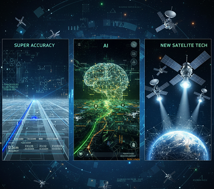
This year, the Global Positioning System (GPS) and its international counterparts did not just receive an upgrade—they underwent a quiet revolution. What was once a reliable utility for turn-by-turn directions has blossomed into a foundational layer for a smarter, safer, and hyper-connected world. From centimeter-level precision becoming mainstream to sophisticated artificial intelligence predicting traffic patterns, 2025 marked a transformative period where GPS evolved from a standalone navigation tool into an intelligent, resilient ecosystem. Here is a comprehensive look at the key advances that defined 2025.
1. The Dawn of “Super GPS”: Centimeter-Accuracy Goes Mainstream
The biggest story of the year was the commercial rollout of civilian centimeter-accurate positioning. Research from Wuhan University demonstrated that combined GPS, Galileo, and BeiDou configurations reduced static convergence time to under five minutes while achieving horizontal accuracy below two centimeters. This breakthrough in Precise Point Positioning with Real-Time Kinematic (PPP-RTK) technology represents a quantum leap from traditional GPS accuracy of two to three meters.
The technology leverages advanced L5 and L1C satellite signals, precise point positioning corrections from low-Earth orbit satellite constellations, and on-device artificial intelligence. Point One Navigation, a San Francisco startup, secured thirty-five million dollars in Series C funding after demonstrating their GPS technology achieves one-centimeter precision across more than one hundred fifty thousand vehicles. The company’s customer base grew tenfold in the past year, spanning automotive, robotics, and industrial sectors.
What It Means for Consumers and Industry
Forget questioning “which lane” you occupy—your car now knows its position within the width of a paint stripe. Testing of new navigation systems in urban environments demonstrated position errors under ten centimeters ninety percent of the time, enabling reliable, affordable centimeter-level precision for autonomous vehicles and consumer devices.
For the average user, this translates to pin-point delivery drop-offs, augmented reality games that seamlessly blend with physical objects, and hiking applications that can guide you to a specific trail marker. Multi-frequency GNSS receivers accessing signals from GPS, GLONASS, Galileo, and BeiDou significantly enhance accuracy and reliability, improving signal availability and reducing the risk of signal loss or interference.
In agriculture, the ability to implement precision farming techniques improves crop yields and reduces waste. Construction sites benefit from accurate measurements that reduce errors and costly rework. In dynamic tests, including real-world vehicular trials, PPP-RTK achieved sub-five centimeter accuracy with instant or near-instant convergence, even under rapidly changing observation environments.
The technology has particular significance for autonomous vehicles. Level 3 and higher autonomous vehicles require precise positioning to safely navigate highways, execute lane changes, and maintain safe distances from other vehicles. The widespread availability of centimeter-accurate positioning removes one of the critical barriers to deploying fully autonomous systems on American highways.
2. LEO Constellations Become the Ultimate GPS Wingmen
The year 2025 solidified an unexpected partnership between traditional Medium Earth Orbit GPS satellites and the proliferating megaconstellations in Low Earth Orbit. While Starlink and OneWeb were primarily deployed to provide global internet connectivity, researchers discovered these networks could provide dual service: high-bandwidth internet and global, real-time atmospheric and clock correction data for navigation.
Research Breakthroughs in LEO Navigation
Research from Ohio State University demonstrated that exploiting Starlink and OneWeb LEO signals with height data from a ship sailing off the west coast of Greenland significantly increased navigation accuracy, effectively reducing errors from more than a kilometer without GPS to twenty-seven meters. This groundbreaking work showed that satellite constellations not designed for navigation can be repurposed for location services.
Signals from LEO satellites are thousands of times more powerful than GNSS signals, making them more secure and much harder to interrupt by malicious actors. The researchers accomplished this without assistance from satellite operators and without access to actual data transmitted through the satellites—only publicly available information about downlink transmission frequencies and rough satellite location estimates.
Enhanced Coverage and Reliability
As of May 2025, Starlink operates approximately seven thousand satellites present across all latitudes, while OneWeb’s six hundred satellites are more plentiful near the north and south poles. This complementary coverage pattern creates a robust global navigation backup system.
What It Means for Global Navigation
This collaboration dramatically improves signal integrity and reduces convergence time for high-precision services from minutes to seconds. It also significantly boosts reliability in urban canyons where tall buildings traditionally blocked GPS signals. Your phone or car can now seamlessly fuse signals from GPS, Galileo, and LEO satellites, maintaining a lock even in dense downtown areas where signals were traditionally lost.
The research has vital implications for aerospace and defense. Better navigation signal security might lower the risk of international incidents, as many officials suspect escalating cyberattacks caused both the Strait of Hormuz ship collision and the downing of Azerbaijan Airlines Flight 8243. The stronger LEO signals provide a resilient alternative when GPS is jammed or spoofed.
3. AI-Powered Predictive and Threat-Aware Navigation
GPS received a comprehensive brain transplant in 2025. Navigation applications are no longer merely consulting historical traffic data—they have evolved into artificial intelligence co-pilots. Using machine learning models fed with real-time GPS flow data, weather patterns, calendar events, and even social sentiment analysis, modern systems predict congestion and hazards ten to twenty minutes further into the future than previous generations.
Predictive Analytics and Dynamic Routing
AI-driven route optimization systems process massive amounts of data, including historical traffic trends, live road conditions, and weather updates, enabling the creation of highly efficient routes that continuously improve over time. Unlike traditional static maps, these systems adapt dynamically, reducing delays and fuel consumption.
Major navigation platforms implemented proactive alerting systems. Systems analyze past and real-time data to forecast potential issues and identify opportunities, enhancing decision making through predictive capability that represents the next evolution in GPS technology. Waze and Google Maps began issuing alerts such as: “Slowing detected four miles ahead, likely due to an incident. Recommending alternate route now to save twelve minutes.”
AI-Powered Mapping Infrastructure
AI-powered maps incorporate constantly changing inputs like traffic flow, construction activity, road closures, and weather conditions—data streams that traditional static maps cannot accommodate. Beyond reacting to real-time events, these systems understand context, recognizing nuances such as school zones that change by time of day, hazardous intersections, low-clearance bridges, and the availability of electric vehicle chargers.
HERE HD Live Map replaces static updates with a continuous data stream, ensuring downtown intersections altered by roadwork are immediately reflected without waiting for scheduled updates. These maps fueled by billions of data points use predictive modeling to foresee traffic buildups, potential hazards, or shifts in road accessibility.
Threat-Aware Systems for Aviation and Maritime
New “Threat-Aware” GPS systems for aviation and maritime use artificial intelligence to predict signal interference or spoofing zones, suggesting safer corridors. Real-time driver coaching through audible and visual cues helps drivers achieve safer outcomes, while automated incident detection and traffic pattern analysis extend far beyond traditional GPS functionality.
For logistics companies managing large fleets or complex multi-stop routes, predictive analytics helps teams avoid bottlenecks before they occur, reducing last-minute route changes and ensuring on-time deliveries. The proactive approach represents a fundamental shift from reactive navigation to anticipatory guidance.
4. The Rise of PNT Resilience: GPS Is Not the Only Game in Town
Growing concerns about jamming and spoofing, highlighted by global conflicts, accelerated the adoption of Alternative Positioning, Navigation, and Timing systems. The year 2025 witnessed unprecedented levels of GPS interference that spurred rapid development and deployment of backup systems.
The Escalating Threat Landscape
The scale of GPS interference reached alarming levels throughout 2025. GPS jamming and spoofing now threaten over fifteen hundred flights daily, affecting commercial aviation with direct threats to flight safety and operational efficiency. During the first four months of 2025, Sweden alone registered nearly one hundred twenty-three thousand incidents of GPS jamming or spoofing.
Between June thirteenth and June twenty-fourth, more than twelve thousand spoofing incidents were recorded, impacting over three thousand vessels worldwide. Of the vessels affected, ninety-seven percent experienced position “jumps” onto land, generating false port calls and triggering screening alerts across multiple systems.
Analysts estimate more than seven hundred jamming or spoofing incidents occur worldwide each day, underscoring how widespread the problem has become. The interference affects critical infrastructure from aviation and maritime operations to telecommunications and financial networks.
Industry Response and New Technologies
In response to these threats, Iridium unveiled a dedicated miniature application-specific integrated circuit measuring just eight millimeters by eight millimeters in October 2025. The Iridium PNT ASIC can be integrated into devices ranging from consumer products to major infrastructure systems like power grids, transportation systems, and telecom networks.
The Iridium PNT ASIC receives a cryptographically secure time and location data signal from the Iridium satellite network that is one thousand times more powerful than GPS and capable of working inside buildings. This revolutionary chip enables comprehensive protection against jamming, spoofing, and time interruptions.
Terrestrial and Sensor Fusion Solutions
Major deployment of terrestrial “pseudolites”—ground-based transmitters broadcasting GPS-like signals—covered critical infrastructure including ports and airports during outages. High-end smartphones and vehicles now standardize the fusion of GPS data with inputs from inertial measurement units, camera-based visual odometry, and ultra-wideband sensors. This allows devices to dead reckon with astonishing accuracy when satellite signals are denied.
What It Means for Critical Infrastructure
A September 2024 report cited a five hundred percent increase in the spoofing of commercial airliners, with an average of fifteen hundred flights daily encountering GPS spoofing. Economic risks are estimated at billions of dollars per day globally. A single-day GPS outage in the United States could cost the economy approximately one point three billion dollars when adjusted for 2025 inflation.
The development of resilient PNT systems ensures that critical operations from air travel to financial trading can continue even when primary GPS signals are compromised. For consumers, these backup systems provide confidence that navigation will remain functional during interference events.
5. Quantum Clock Prototypes and the Future of Timing
While quantum-enhanced atomic clocks remain primarily in research laboratories, 2025 witnessed significant milestones that promise revolutionary improvements for future GPS satellite fleets.
Laboratory Breakthroughs
In July 2025, researchers at NIST reported a record-setting optical atomic clock based on a trapped aluminum ion, achieving systematic uncertainty corresponding to around nineteen decimal places of accuracy. This quantum logic clock represents a forty-one percent improvement over the previous record and is two point six times more stable than any other ion clock.
These optical clocks operate at frequencies much higher than current microwave-based atomic clocks. While today’s microwave-based atomic clocks on GPS satellites provide ten-nanosecond timing, optical clocks could provide ten-picosecond precision—a thousand-fold improvement in timing accuracy.
Field Deployment and Naval Tests
Researchers made substantial progress in making quantum clocks portable and robust enough for real-world deployment. Optical quantum clocks demonstrated in naval exercises achieved timing precision twenty to two hundred times greater than current GPS standards, maintaining stability under shipboard conditions. The clocks, utilizing rubidium and ytterbium atoms, were tested at the Rim of the Pacific naval exercises in Hawaii, withstanding the rigors of being rocked by waves.
Miniaturization Efforts
Progress in miniaturization promises to bring quantum clock technology to broader applications. NIST scientists fabricated a chip-scale atomic beam device using a stack of etched silicon and glass layers, creating a highly miniaturized version about the size of a postage stamp. These advances combine the stability of traditional beam clocks with the low power consumption of chip-scale designs.
What It Means for Future GPS
A more stable clock on a satellite translates to a more accurate signal for everyone on the ground. JILA’s Jun Ye has envisioned a global network of entangled space clocks that could provide a time standard far more accurate than present-day GPS. This research and development paves the way for next-decade systems that could be one hundred times more accurate and resilient than today’s already impressive technology.
Optical clocks are being explored as eventual replacements for the clocks on GPS satellites once they are sufficiently miniaturized and ruggedized. The enhanced precision would allow devices to require fewer updates and operate independently for longer periods, critical for military operations and GPS-denied environments.
The Bottom Line for 2025
The story of GPS in 2025 is one of integration, intelligence, and resilience. GPS stopped being a standalone service and became a synergistic part of a larger PNT ecosystem—supercharged by LEO networks, refined by artificial intelligence, backed up by terrestrial alternatives, and protected against emerging threats.
For consumers, these advances mean uncanny accuracy and reliability. Your smartphone can now guide you with precision previously available only to professional surveyors. Navigation apps anticipate problems before they materialize, routing you around traffic jams that have not yet formed. Even when GPS signals are jammed or spoofed, backup systems ensure you can still find your way.
For industries ranging from logistics and agriculture to aviation and finance—where precise timing is crucial—2025’s advances unlock new levels of automation, safety, and efficiency. Autonomous vehicles move closer to widespread deployment with centimeter-accurate positioning. Farmers optimize crop yields with precision guidance. Ships navigate safely even in contested waters where GPS is actively jammed.
The humble act of “checking your location” has become one of the most technologically sophisticated processes of the modern world. The year 2025 was when we all felt it click into a new gear—a year when GPS technology matured from a navigation tool into an intelligent, resilient, and indispensable infrastructure upon which modern civilization increasingly depends.
As we look toward 2026 and beyond, the trajectory is clear: GPS and global navigation satellite systems will continue to evolve, becoming more accurate, more intelligent, and more resilient against both natural and human-made threats. The foundation laid in 2025 ensures that wherever you go, whatever you do, positioning, navigation, and timing services will be there—precise, reliable, and ready to guide you forward.
*) If you enjoyed this article, here are some related posts you might find interesting.